HW/SW Prototype Development
The S3 Environmental Sensing team has extensive experience and expertise in developing prototype hardware and software for model validation, proof-of-concept verification, and scientific experiments in the field.
Hardware Prototype Development
S3 personnel have been developing laser- and lidar-related hardware prototypes for more than 15 years. Many of these prototype systems have evolved into science instruments or systems capable of extended field deployments collecting valuable data about our environment.
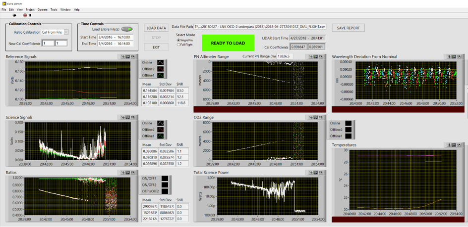
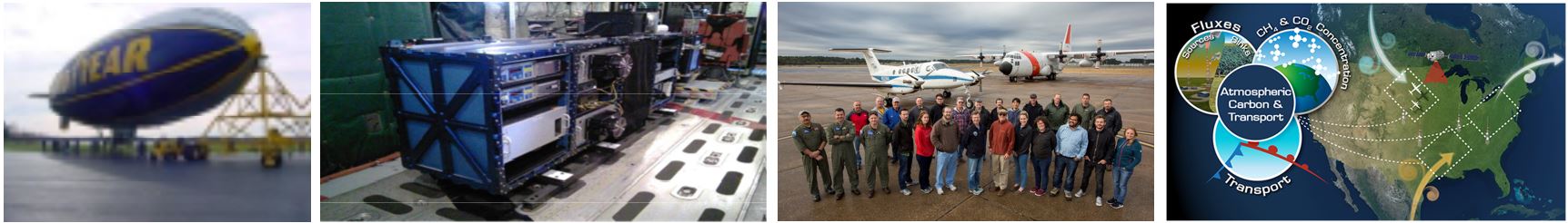
The MFLL airborne system was first deployed on a Goodyear airship as a proof-of-concept prototype to demonstrate the first ever CW integrated path differential absorption measurement of carbon dioxide (CO2). The system has since evolved into a key instrument flown on the NASA C-130 as part of the Atmospheric Carbon & Transport (ACT)-America mission. Other prototype demonstration units were developed from this underlying technology, such as the multi-pixel pseudo-random noise altimeter for ice sheet mapping.
The MFLL airborne system was first deployed on a Goodyear airship as a proof-of-concept prototype to demonstrate the first ever CW integrated path differential absorption measurement of carbon dioxide (CO2). The system has since evolved into a key instrument flown on the NASA C-130 as part of the Atmospheric Carbon & Transport (ACT)-America mission. Other prototype demonstration units were developed from this underlying technology, such as the multi-pixel pseudo-random noise altimeter for ice sheet mapping.
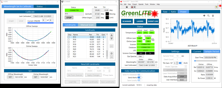
GreenLITE™ was built with partial funding by the Department of Energy to demonstrate the ability to measure and map CO2 concentrations over carbon storage facilities. Additional prototype systems have been developed to extend the measurement coverage area from 1 km2 to 25 km2 and to measure and map CH4, allowing the system to be used for safety applications as well. These prototype systems have proven to be quite robust throughout multiple extended field deployments around the world.
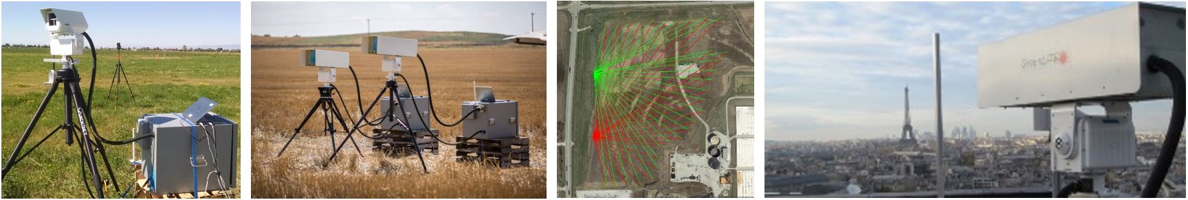
The Laser Atmospheric Transmitter Receiver-Network (LAnTeRN) prototype used a forward scatter lidar to demonstrate one-way integrated path measurement of CO2 to eliminate partial-path bias that can occur in traditional backscatter lidar. The system was demonstrated on Italy’s Mount Etna as part of an initiative by the Deep Carbon Observatory to seek new ways to measure sources of carbon.
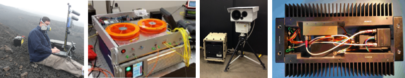
Additional hardware prototypes designed, built, or tested by S3 personnel include high-power fiber Raman laser amplifiers, the REVEAL eye-safe scanning backscatter lidar, and an active short-wave infrared (SWIR) imaging (ASI) system.
Software Prototype Development
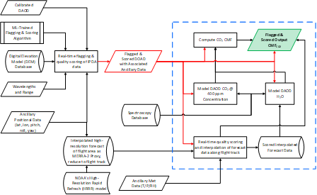
The S3 team has developed software encompassing a broad range of applications including data acquisition, data processing, data analysis, hardware control, and physics-based modeling, written primarily using the NI LabVIEW™ programming environment and MATLAB®. S3 developed a prototype real-time column mole fraction (XCO2) retrieval algorithm for NASA and demonstrated it with MFLL flight data and High Resolution Rapid Refresh (HRRR) forecast data.
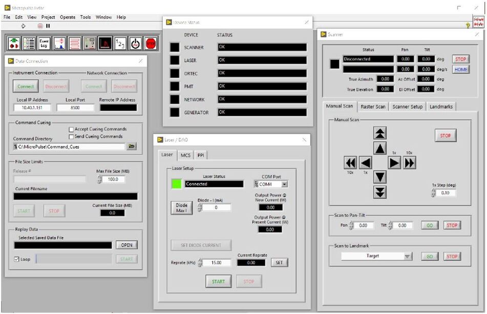
The software that operates all of the aforementioned prototype hardware systems was developed by the S3 team.